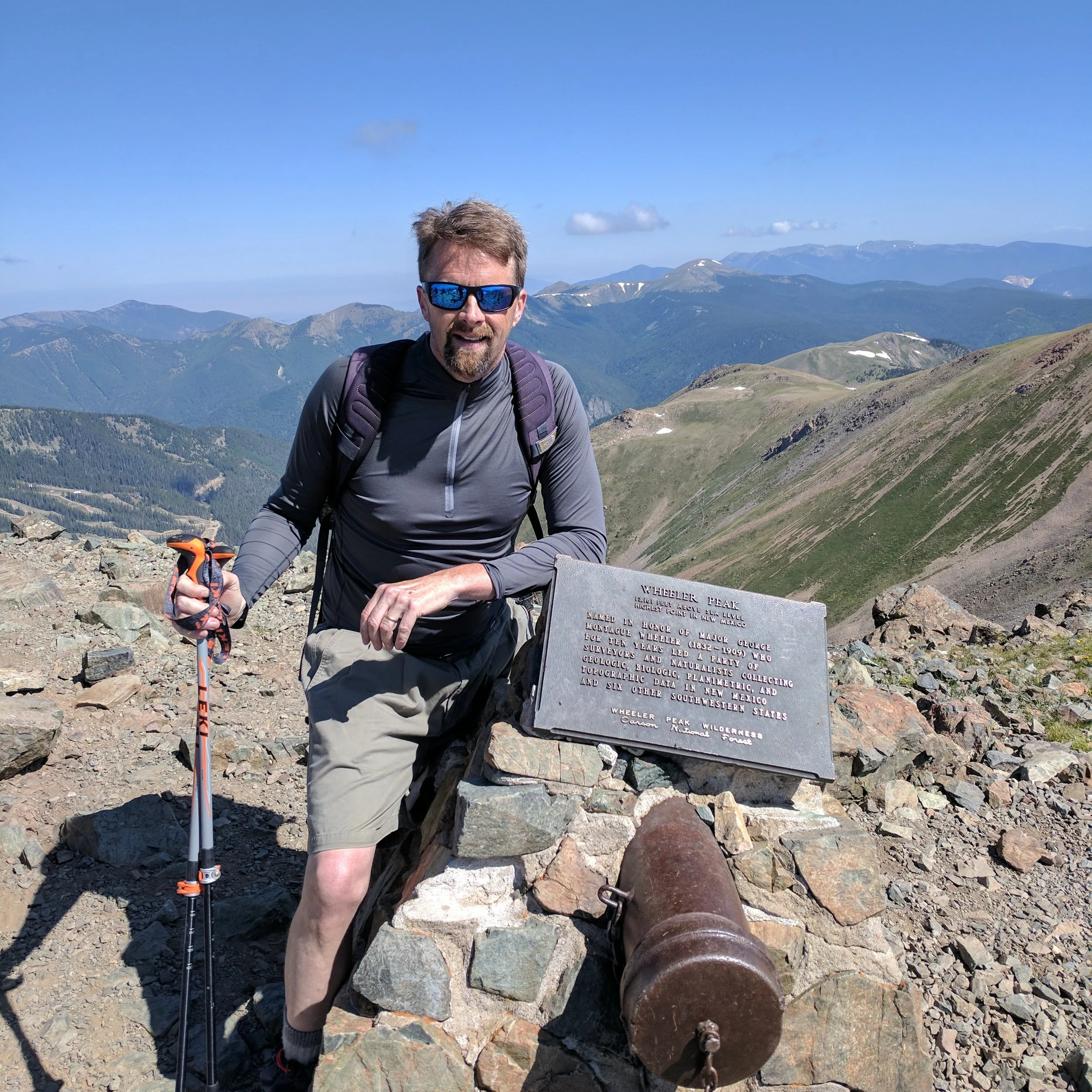
Over three days, I bagged five state high points. Not bad if I do say so myself. I flew into Denver on Tuesday, July 3rd and got in at about 10 PM. I checked my bag in which I knew was a mistake and took forever to come out; although I was at the wrong carousel for a while which did not help. I got my vehicle which was another Nissan Rogue and would allow me to sleep in the car. I took my sleeping bag this time so I would not run into the hotel issue from last Fourth of July weekend and my trouble in Stowe last Fall. I drove for about an hour and a half on I-70 East until I ran into a random rest area, parked, peed and went to bed.
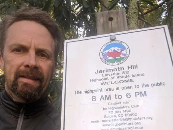
This was my kind of high point. Essentially a drive up. Nice location and I had it all to myself.
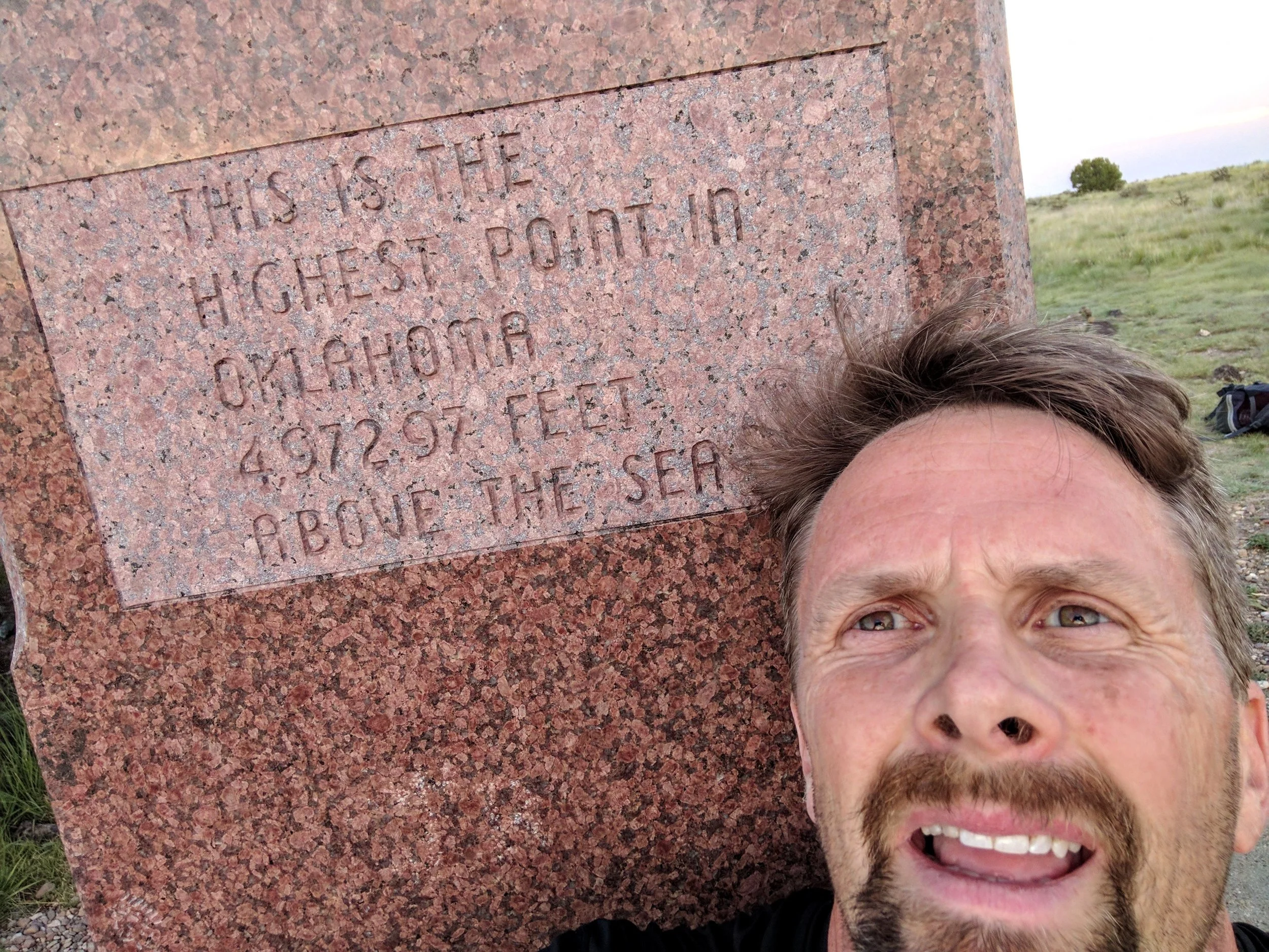
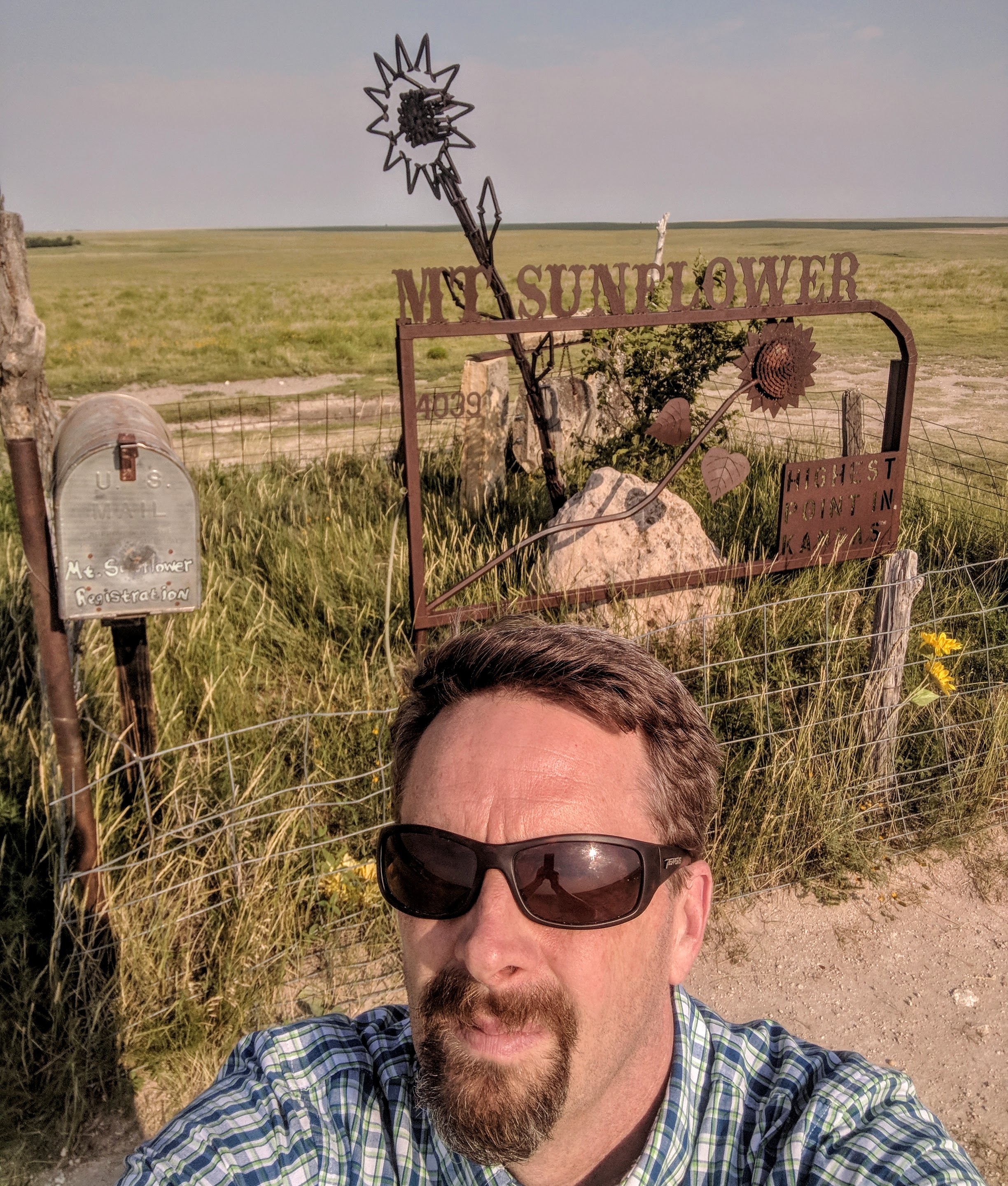
I woke up fairly early the next morning, got dressed and got on the road. I found some coffee at a local gas stop and kept heading east towards Kansas’ high point. You drive into Kansas and then head south shortly thereafter. I had to drive on some pretty rural roads and the second half after getting off of i-70. In short order, I rolled into the road into Mount Sunflower. A little part of me thought maybe I should walk in but I opted to drive. It was a nice spot and there was a fairly significant marker for this high point. That it is the highest is hard to tell as you survey the land around you. And the overall altitude is just over 4,000 feet which is hard to believe. I took the requisite pictures and headed north toward South Dakota.
I worked my way north on State Highway 385 towards Rapid City. I went through Nebraska and even though I was close to the state high point, I decided to get that one on the way back to Colorado. The scenery was very interesting and I saw a lot of coal coming out of Easter Wyoming through the Platte River Valley by train. This was a little depressing.
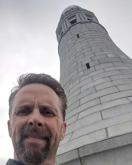
You enter the Black Hills National Forest shortly after entering South Dakota. The terrain started becoming interesting. I arrived at Sylvan lake Campground which had an entry fee and was pretty busy. That caught me off guard a little, but I got in and put on my hiking gear to start what appeared to be a somewhat easy but interesting loop to Harney Peak or now Black Elk Peak. The scenery was nice and within about 45 minutes I had arrived at the peak. There was a very elaborate entrance carved into the rock and a tower to climb and see a 360-degree view of some pretty remarkable sites.
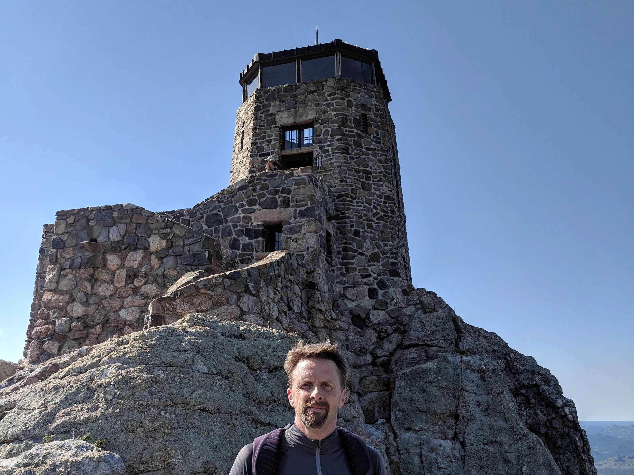
There was quite an impressive lookout tower at the top of Black Elk Peak in South Dakota.
I had a very pleasant hike out. I saw a bunch of deer which was nice and then found my car. I got into my driving clothes and started heading north to White Butte in North Dakota. I was really close to Mount Rushmore and they were having a big Fourth of July celebration. That would be really great to see but I was on a mission to bag these peaks! Driving through Deadwood was a bit of a surprise. What an interesting place. I thought maybe some time in my life I might have to return. I grabbed some food and kept driving.
I arrived in Bowman, North Dakota and decided that this would work for an easy and early effort to hike White Butte. I found a back lot near a gas station where a bunch of semis were parked and found a good spot. I looked around scenic Bowman and this seemed to be the best spot. They were lighting off fireworks seeming all night which made going to sleep a little challenging but I finally managed to get some rest.
I woke up in the morning after a pretty good night and got dressed. I walked over to the gas station and got some coffee and a little food and headed north. The scenery on this drive was really nice on a sunny summer day. Rolling hills of grass with buttes popping out here and there. I entered into some farm roads and slowly worked my way to the entrance of White Butte. You had to drive essentially three sides of a square to get there. This high point is on private property and there some conflicting information about access. I drove into the road as far as I felt comfortable. In retrospect, I probably should have walked in that last portion. I got dressed and headed up the road to the trail.
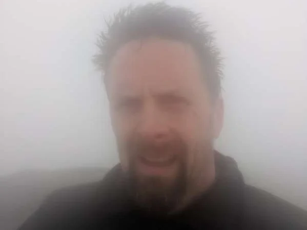
The landscape here is a bit strange. There is erosion that exposes this white sandy rock. I was heading up, there was a deer against and all-white background which would have made a pretty dramatic picture. I missed it though because I could not get my phone out quick enough. The trail up is pretty short and before I knew it, I was at the top. The views were great and I really soaked it in.

I thought it was odd the elevation here was below Kansas. None-the-less, White Butte was memorable.
I headed back to the car and was back pretty quickly. I spotted someone hiking in as I was getting out of my hiking clothes; which was probably unnecessary for this hike. We chatted and he was doing the same thing I was. He had just been to the Nebraska high point and recommended I stop in at a ranger station for that one. I never did.
I started heading south and towards Panorama Point in Nebraska. I had to cut into Wyoming for a bit and attack the high point from the west. The directions seemed pretty straight forward so I just went straight there despite the advice I had gotten earlier in the morning. I arrived there mid-afternoon and like Kansas, this one was a drive up as well. Very nice and the buffalo one the way in were interesting. I took the pictures, soaked in the scenery, made a donation on the way out and started heading for Twin Lakes in Colorado.

This was pleasant and easy one to check off the list.
I headed due south to I-76 and then 1-70. I grabbed some gas and a Chipotle bowl and then headed to meet my buddy at Twin Lakes campground. I managed to find the campground and his spot. It was good to see Clay Cox and I had not seen for a while. Since I had gotten there at a somewhat reasonable hour, I wanted to climb in the morning. I had stopped at a store for food and water for the hike. Clay seemed up for it. We finally went to bed for a 6 AM wake-up.
The morning arrived and it was sunny and cool. I was ready to go. Clay, on the other hand, said his gout was acting up and he was going to bail. I was looking forward to having a partner for the third highest peak. He gave me a ride up the road as far as he could get in his Lincoln Navigator, but it was not to the trailhead. This was a bit of a rough start and I wondered if I was going to actually pull this off. I had extra days so it did not need to happen this day. I kept walking up this road for about a mile and a half and finally got to the trailhead. This was good. There was no one around so I forged on.
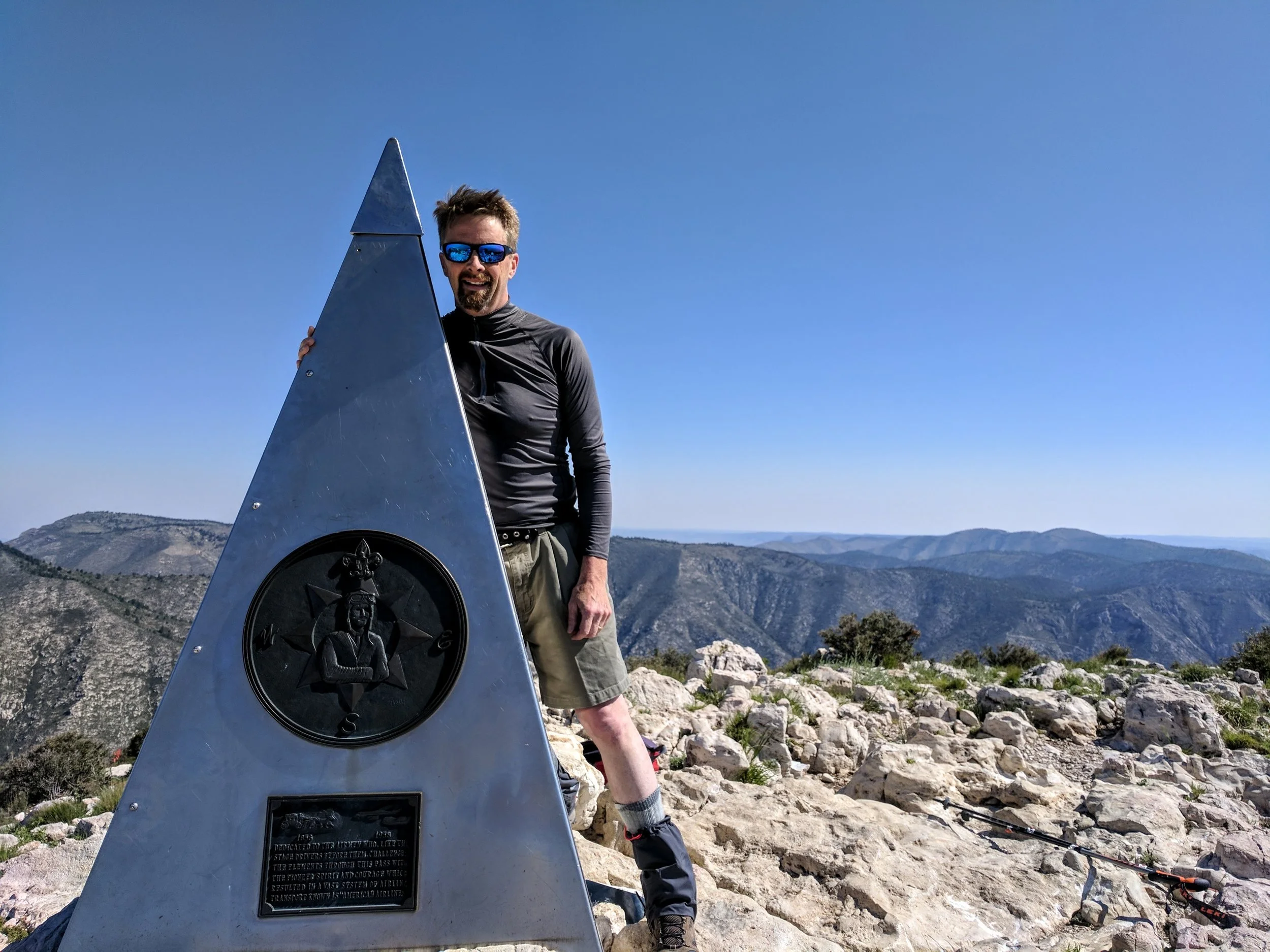
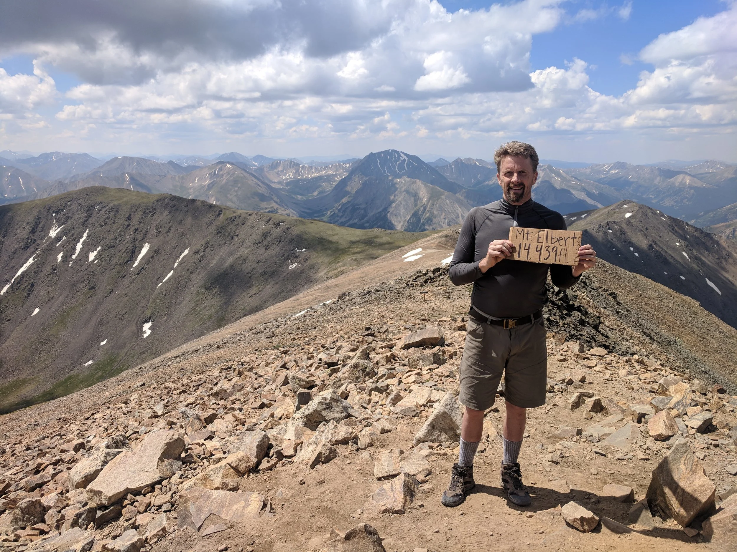
I began my journey up and things were improving. I finally got out of the treeline and could see the top. I was able to do what I do best which is grind through it, and Mount Elbert turned to be a grind. There was a section toward the top that was pretty steep. As I got to the top there were a fair number of people up there. I could see the top and the end, but it proved to be harder than it looked. I finally made it to the top. I was happy. I enjoyed some snacks. Someone had fashioned a sign made out of cardboard which I posed along with the official marker. I then went down. This was a bit taxing but I was happy to be done with this adventure and perfect on the peak bagging!
This was a good one and I had to push to get it done.